Example of galloping power lines, courtesy Midwest Energy
Hays Post
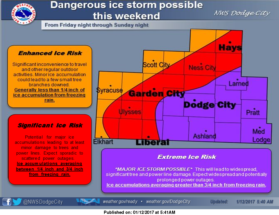
Meteorologists are warning the upcoming storm could be “one of the worst ice events in the last decade.”
Larry Ruthi of the National Weather Service’s Dodge City office said the Hays area is expected to be affected beginning Saturday afternoon. He compared the impending storm to the 2006 ice storm, although he didn’t expect it to be quite that severe.

Depending on the temperature, sleet could precede a significant amount of freezing rain.
“Ice could accumulate to three quarters of an inch to an inch — and it could be more,” he said. “That’s enough to cause some real problems with power lines, trees and travel.”

The ice storm is expected to last through Sunday, with the weather changing Monday morning — wind and snow.
Ruthi said, come Monday morning, north winds will increase to 20 mph, with the possibility of a couple of inches of snow.
The wind, if the expected ice arrives, could cause “all kinds of problems” with galloping power lines, he said.
Ruthi said the NWS is regularly updating the path and predictions for the storm, noting several variables could change the severity of the ice, including how hard the rain falls. The harder the rain, the better the chance it runs off before freezing, he said.
By Wednesday, Ruthi said milder temperatures should return to the area, with a high temperature in the low 40s.
Check Hays Post and tune into your Eagle Radio of Hays stations for the latest on severe weather and cancellations. Area cancellations can be found HERE.