 Hays Post
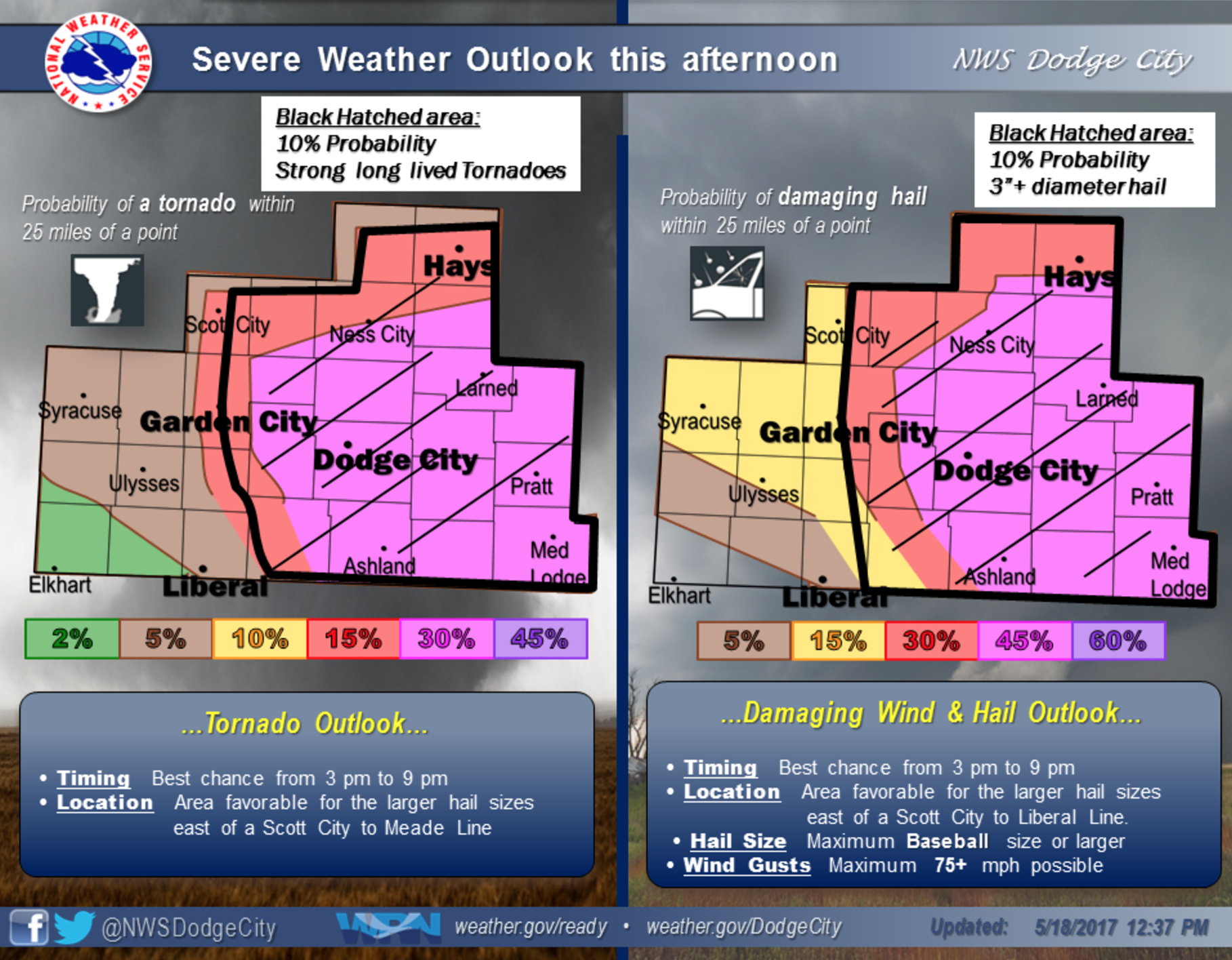
That National Weather Service is warning of a strong storm that is expected to fire up this afternoon and evening in western Kansas.
Thursday’s storm brings an increased risk of tornadoes, large hail, high winds and thunderstorms.
The NWS said the area at risk is east of a line extending from Scott City to Liberal. Hays is on the northwest fringe of the high-risk area. Click the image for more.
Just after 12:30 p.m., the NWS said hail could be baseball-sized or larger with winds gusting to 75-plus mph.
The greatest risk of tornadic activity is south of Hays, but the risk area includes most of Ellis County.
In case of severe weather, stay tuned to your Eagle Radio stations and check HaysPost.com.
As inclement weather approaches, please take proactive precautions to stay safe. After a storm has passed, continue to keep safety in mind and give utility workers and law enforcement the necessary space to do their jobs and help those in need. Stay away from downed power lines and always assume they are energized. This safety message is brought to you by Sunflower Electric Power Corporation.