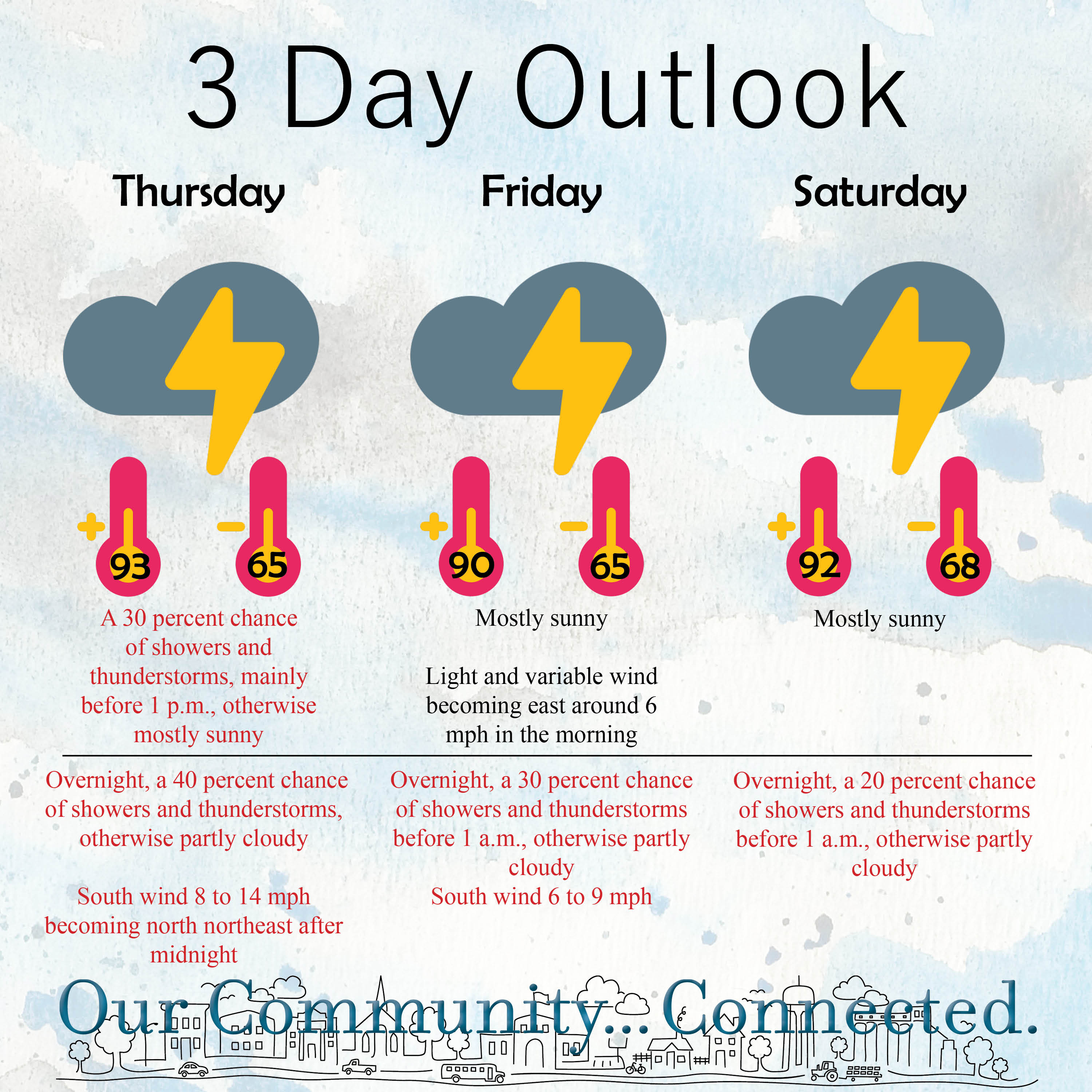
Chance for additional storms returns in the coming days
By JAMES BELL
Hays Post
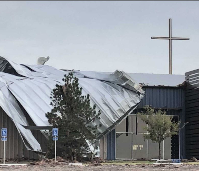
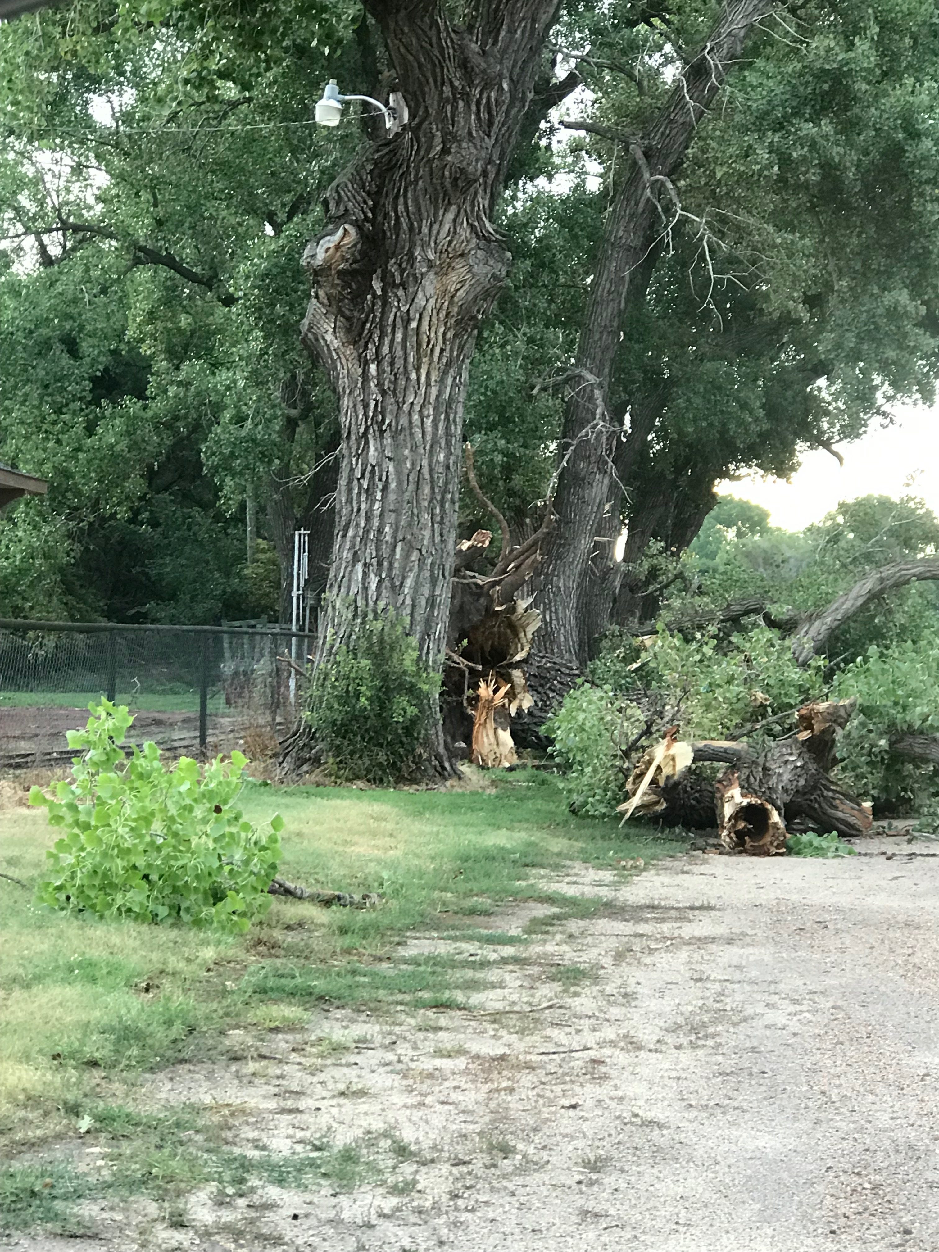
The storm that moved through Hays on Tuesday brought hurricane-force winds with it, damaging homes and business throughout Ellis County and the region. But even though the storm did not produce tornados in the area, it demonstrates the destructive power of thunderstorms and associated winds.
“People see severe thunderstorm warning and get almost complacent,” said Bill Turner, lead forecaster at the National Weather Service in Dodge City. “They see the warning and think ‘Big deal, I have been through 84 million of those.’ ”
Strong winds can create significant damage but are often dismissed by the public, he said, due to the frequency of severe thunderstorm warnings across Kansas.
“When you get winds of 80 mph, we put different wording in the warnings, but it’s hard to get the message across that this wind is 80 mph,” he said. “There is a world of difference between a wind of 80 mph and a wind of 60 mph. It’s exponentially worse.”
Discussions about the destructive winds associated with Tuesday’s storm began early Tuesday morning, and the NWS had issued watches and warnings in advance of the approaching storm.
“The watch was up for damaging winds. Social media was covered with stuff,” Turner said. “I think we proved to a lot of people that you don’t need a tornado to rip some stuff down.”
RELATED: 🎥 ‘Blessed no one was hurt,’ say pastors of storm-damaged Ellis Co. church
The level of damage seen in Hays, he said, was directly related to the length of the wind gusting.
“One of the things that made this worse, that was working against us yesterday, wasn’t just the initial wind guests and then it was over, the initial wind gust hit and it continued to gust in some cases 20 to 30 minutes,” Turner said.
At the Hays airport, he said two wind gusts up to 70 were recorded for 20 to 25 minutes.
“There is a big difference between gusting for a few seconds than gusting for 30 minutes,” Turner said. “That’s a long time to batter stuff so stuff weakens and breaks, and the damage is amplified.”
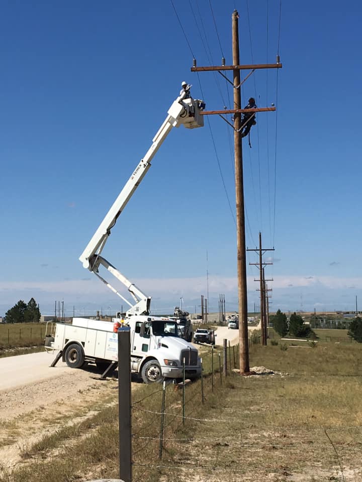
The power transmission lines coming down near Interstate 70 was particularly telling of the strength of the winds.
“It probably took 10 to 15 minutes of hurricane-force winds to take those down,” Turner said.
RELATED: Hays High football team helping with cleanup efforts
Because the wind associated with the storm was so significant, warnings were issued long before the storm front moved into Ellis County in order to give people time to prepare, he said.
“Sometimes we issue a warning and there is nothing going on,” Turner said. “(But) we had 100 percent confident that the thunderstorm complex was going to happen.”
But forecasters were not sure exactly which path those storms would take as they moved across Kansas. Tuesday’s storm began to pick up strength after two storm cells merged around Colby and traveled down the I-70 corridor.
“We weren’t exactly sure if it was going to go south toward Dodge, down 283 or go toward Hays,” he said. “One of the computer models we use a lot took it toward Hays, but it was off on its own, it wasn’t supported by anything else so we broad-brushed the thunderstorms for everybody.
“The details are what really get us in this industry,” Turner said, even with the current technology. “Exactly where that storm is going to go an hour or two in advance is tricky.”
With the severity of the storm Tuesday, Turner said Wednesday night in Hays will be “a lot quieter.”
“After these big events, it takes the atmosphere so time to recover,” he said but added a few small storms could pop up around the Colorado border.
Severe weather could be moving back into the Hays area on Thursday or Friday, Turner said, once the atmosphere has time to reload.
Click HERE for updated weather conditions.