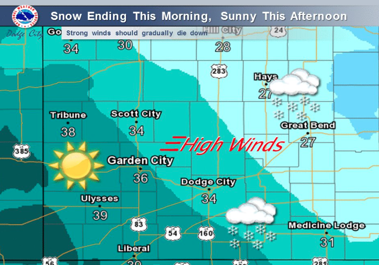
Today Snow likely, mainly before 10am. Widespread blowing snow, mainly before 9am. Cloudy through mid morning, then gradual clearing, with a high near 27. Wind chill values as low as -1. Very windy, with a north northwest wind 33 to 38 mph decreasing to 22 to 27 mph in the afternoon. Winds could gust as high as 55 mph. Chance of precipitation is 70%. Total daytime snow accumulation of less than one inch possible.
Tonight Mostly clear, with a low around 7. North wind 13 to 18 mph decreasing to 5 to 10 mph after midnight. Winds could gust as high as 28 mph.
Friday Partly sunny, with a high near 28. Wind chill values as low as -1. East northeast wind 5 to 10 mph becoming southeast in the afternoon.
Friday Night Mostly cloudy, with a low around 7. Wind chill values as low as zero. East wind 7 to 9 mph becoming north after midnight.
Saturday Mostly sunny, with a high near 21. North wind 6 to 9 mph.
Saturday Night Mostly cloudy, with a low around 12.
Sunday Mostly sunny, with a high near 45.