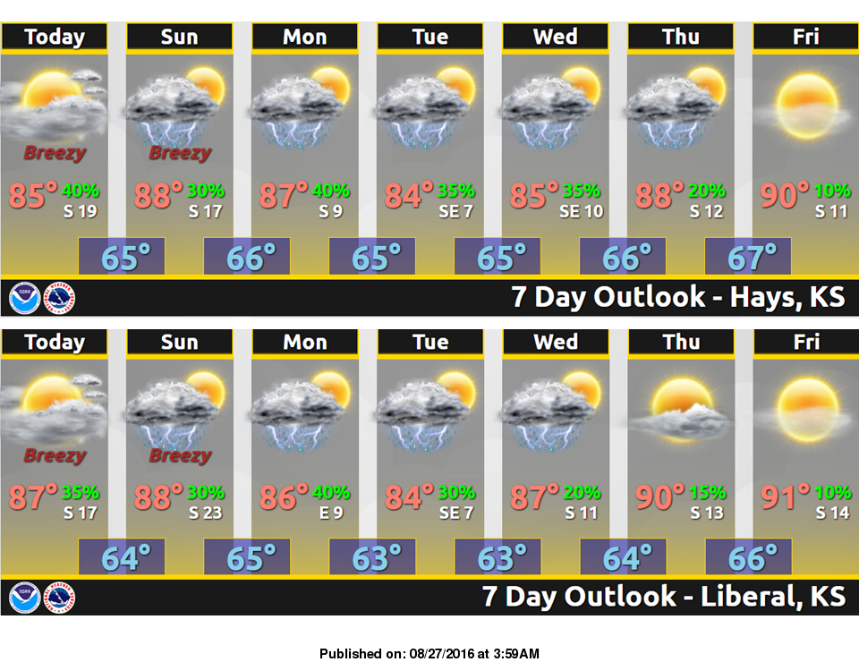
 Breezy and partly sunny conditions today will be matched with highs just a few degrees on the cool side of normal for late August. By late this evening, non severe thunderstorms will again be possible, mainly across the northern counties and the interstate 70 corridor through 4 am Sunday morning.
Looking ahead to the next few days, an unsettled weather pattern will keep periodic thunderstorm chances in the forecast, with high temperatures generally in the 80s.
Today: Mostly sunny, with a high near 85. East wind 5 to 15 mph becoming south in the morning.
Tonight: A 20 percent chance of showers and thunderstorms after 11pm. Mostly cloudy, with a low around 65. South southeast wind 9 to 15 mph.
Sunday: A slight chance of showers and thunderstorms before 9am, then a slight chance of showers and thunderstorms after 4pm. Partly sunny, with a high near 88. South southeast wind 8 to 14 mph. Chance of precipitation is 20%.
Sunday Night: A 30 percent chance of showers and thunderstorms, mainly after 11pm. Mostly cloudy, with a low around 66. Southeast wind 5 to 11 mph.
Monday: A 30 percent chance of showers and thunderstorms. Partly sunny, with a high near 86. South wind 5 to 7 mph.